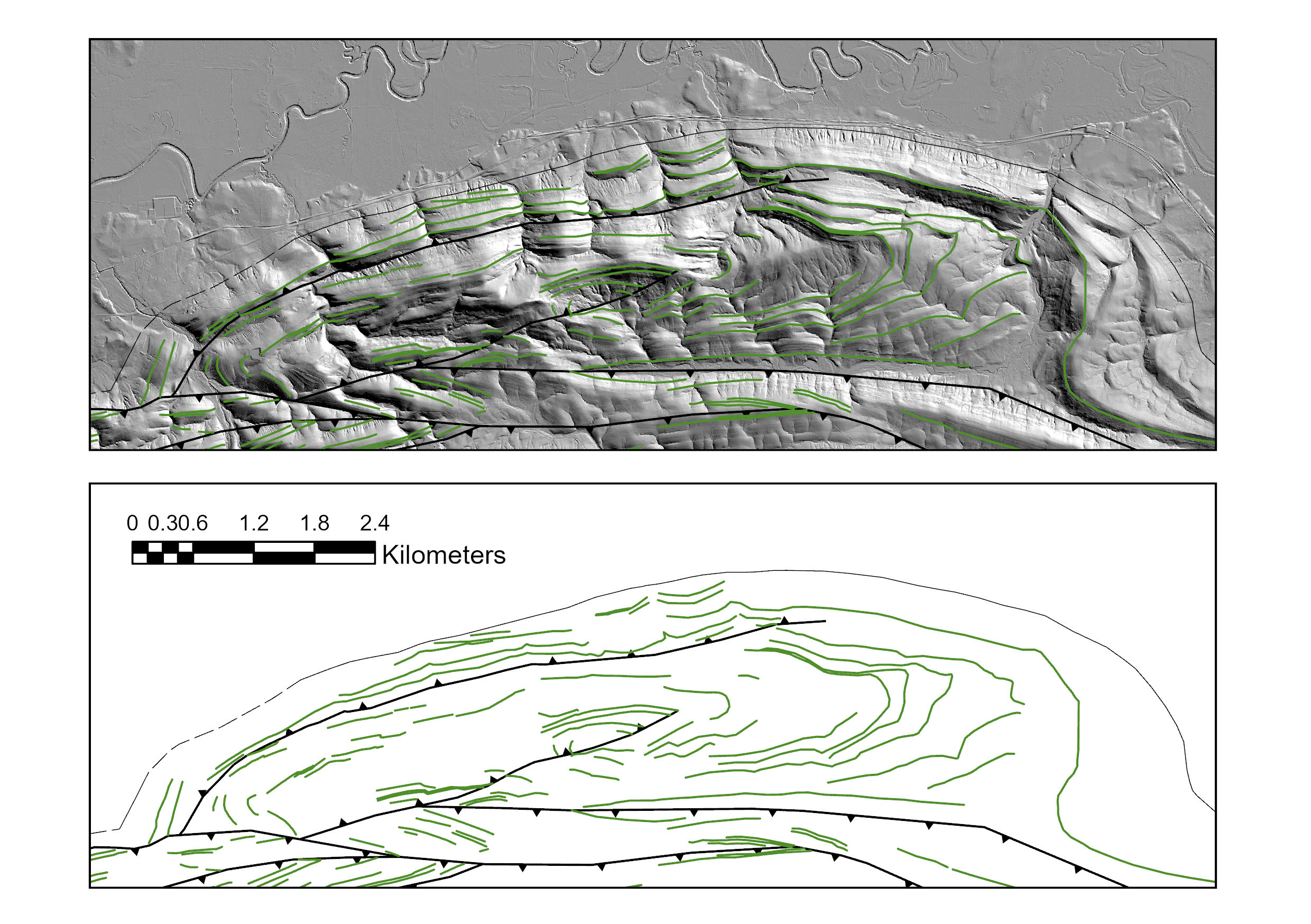
Digital geologic mapping
using high-resolution LIDAR data shows the detailed structure of the Ouachita frontal fold-thrust belt.

It’s cheating
to use this lidar…which is publicly available by the way…

thanks 3DEP
Here is a link: 3D Elevation Program | U.S. Geological Survey (usgs.gov)
DIGITAL GEO MAP DATABASE COMPILATIONS
I have compiled a digital geologic map of the Death Valley Region (see below). There is a link below the image to a .pdf of my preliminary map. The latest version was presented at the Spring 2018 GSA Rocky Mountain/Cordilleran section meeting in Flagstaff, AZ. This map forms the framework for regional-scale 3D models and palinspastic reconstructions of the large-magnitude extension that affected the region.
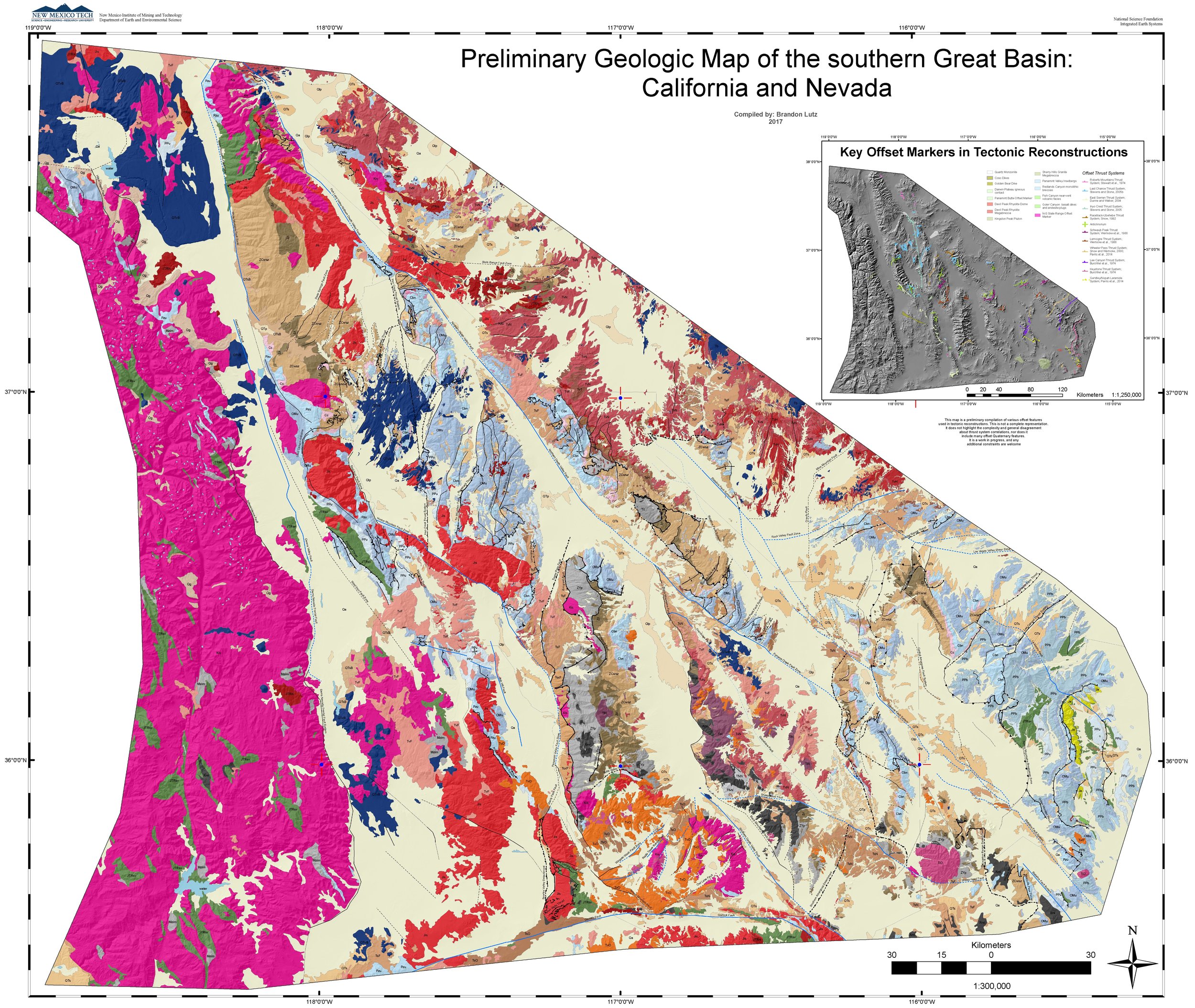
Google Drive link to the latest draft here

